
What does a 30% chance of rain mean?
© Crown Copyright, Met Office
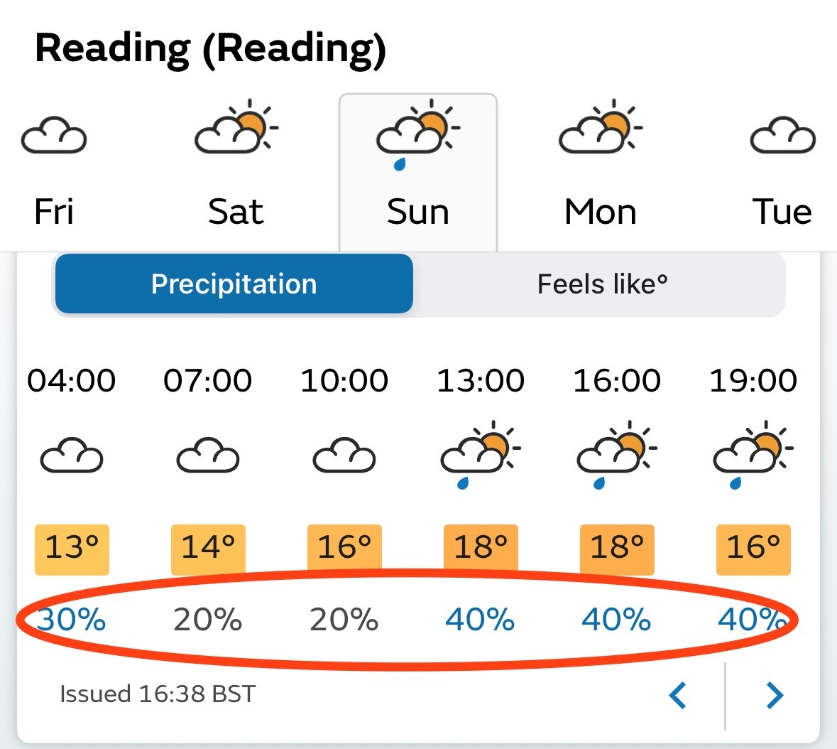
If you look at your favourite weather app, you are likely to find that one of the things it offers is a chance of rain expressed as a percentage, but what does a 30% chance of rain actually mean?
We all know that weather forecasting is not an exact science. Chaos theory was discovered by meteorologist Ed Lorenz in the 1950s, working on early attempts to model the weather using computers, before most people had even heard of computers! Lorenz discovered that if he stopped his computer model and restarted it with very slightly different numbers — he simply rounded off the numbers to three significant places to save typing in the full detail — he got completely different answers a few days into his forecast. Lorenz realised this meant that there would always be a limit to how far ahead we could forecast the weather, because however good our observing systems, we could never know all the exact details of the starting conditions.
Today’s forecast models run on immense supercomputers, exploiting billions of observations every day (mainly from satellites), give incredible detail in forecasts but are still constrained by chaos theory. For large-scale weather patterns the solutions typically start to diverge after a few days, but for fine local detail, including how much rainfall, they can diverge within a few hours into the forecast in some circumstances.
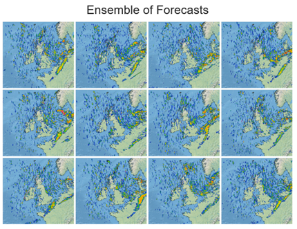
To address the challenge of chaos theory, forecasters run their models many times from very slightly different starting conditions in what are called ensemble forecasts. Ensembles provide a way to estimate the confidence in a particular forecast, and to estimate how likely something is to happen — like the chance of rain. If all the forecasts in an ensemble are similar then the forecaster can be confident and the chance of rain may be 90% or more (or 10% or less, giving high confidence for no rain!). But another day the forecasts may all diverge rapidly, giving less confidence and meaning that the best that the forecaster can say is that there is, for example, a 30% chance of rain.
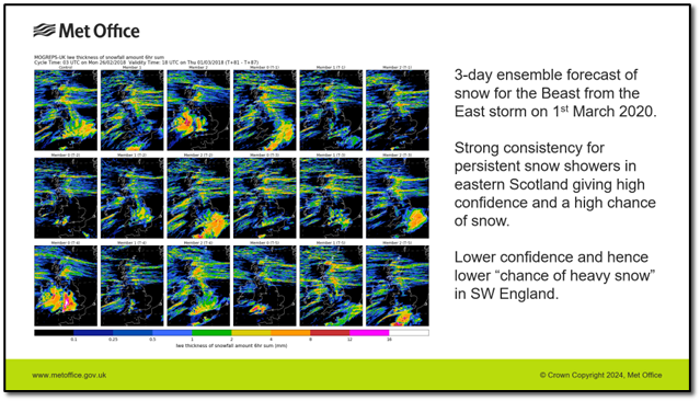
But we come back to the same question — what does 30% chance of rain actually mean? Some people have interpreted it to mean that it will rain 30% of the time, others that it will affect 30% of the area. If we think back to how the number is generated, using an ensemble, we see it isn’t really either of those, but more like 30% of forecast simulations suggest it will rain. Another way to express it, rather clumsily, is that it will rain on 30% of days like today — days when the starting point of the forecast is almost exactly the same as it is today.
In practice, even that interpretation is simplistic and there are many ways that the chance of rain can be calculated from model output, and not all forecasters or app developers will use the same approach. A model or ensemble may output whether or not it is raining “on the hour” or “during the past hour”. During showers or intermittent rain, the latter will give higher probabilities.
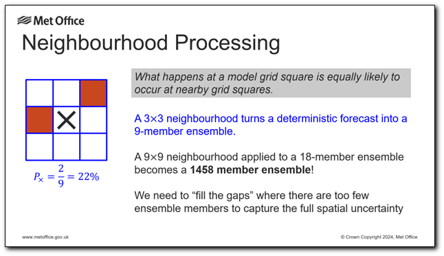
How much rain do you need for an ensemble member to count towards the chance of rain? Most forecast providers choose a small amount, such as 0.2mm in an hour, but it is also possible to calculate the chances of heavier rain which may be more important for many users. For example, what is the chance of a flash flood producing heavy rain? That sort of rain is usually produced by convective showers or thunderstorms. Today’s high-resolution forecast models and ensembles, such as those operated by the Met Office, are capable of explicitly resolving the convective air motions in thunderstorms, but the precise mechanisms for triggering storms are much less predictable. Storms will often be predicted in the right general area but not with the exact right locations or timings. Advanced post-processing systems such as that used by the Met Office, will look not just at the 18 forecasts in the ensemble, but also look at a “neighbourhood” of model grid-boxes around the site of interest for any showers occurring nearby, to get a better estimate of the chance of rain. Going even a step further, for high-impact thunderstorms, users may be more interested in the chance of storms anywhere in the area around them, not just at one location, so we can calculate the chance of storms occurring within, say, 25km, which will be much higher than the chance of getting one overhead.
In terms of how the chance of rain is calculated, it is finally worth mentioning that some providers will calibrate the probabilities which come directly out of the ensembles using past observations. For example, if we look back at all the times when the ensemble forecast a 50% chance of rain and find that it only actually rained on 30% of those occasions, then future forecasts will be adjusted so that an ensemble probability of 50% is presented in the app as a 30% chance.
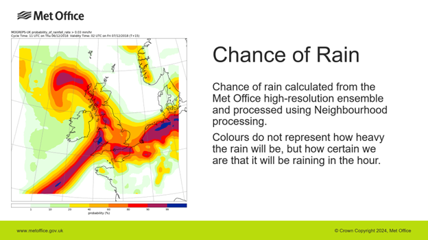
In summary, there are a number of interpretations of "chance of rain", but unless a forecast specifically says it is for heavy rain or within a distance, it can be assumed that it is the chance of any rain in the hour at the location.
One other factor to think about is that most apps will give a chance, or probability, of rain for each hour of the day. These probabilities need to be considered independently of each other, and they tell you little about the probability of rain occurring over a longer period. For example, four consecutive hours with a 25% chance of rain does NOT add up to a 100% chance in four hours! In fact, the chance in four hours could be anywhere from 25%, perhaps if 10 out of 40 ensemble members predict a rain system to spread far enough north to affect the location, to 100% if all 40 members expect a cold front to pass over the site but with different timings.
It is likely that in the future some providers may also offer chances of rain “at some point during the day”, especially for longer range forecasts. Meanwhile, you might be able to help understand the risk better by looking at other parts of the forecast to understand what types of weather systems are producing the rain. For example, if you are using the Met Office app, have a look at the Maps section to see whether the model is predicting scattered showers or a frontal band of rain.
About the Author

Ken Mylne is a Science Fellow in the exploitation of ensemble and probabilistic forecasts at the Met Office.
After early research in pollution dispersion and six years as an operational forecaster, Ken returned to research in ensemble forecasting where he led the development of the Met Office’s MOGREPS ensemble system and its applications.
Over many years Ken has played a leading role in developing the science and demonstrating that probabilistic forecasts provide greater prediction skill and can support better decision-making by users.
He has also played a leading role at the World Meteorological Organization, supporting forecasting capabilities for disaster risk reduction worldwide.
© Crown Copyright, Met Office


