
Notable weather events from the past 175 years
by Kirsty McCabe, FRMetS
2025 marks the Royal Meteorological Society’s demisemiseptcentennial (half of half of 700 years) anniversary. A lot has happened since the society was founded, so MetMatters has dusted off our Weather Diary to look back at some significant weather and climate events from the past 175 years.
1850 – The Uncovering of Skara Brae
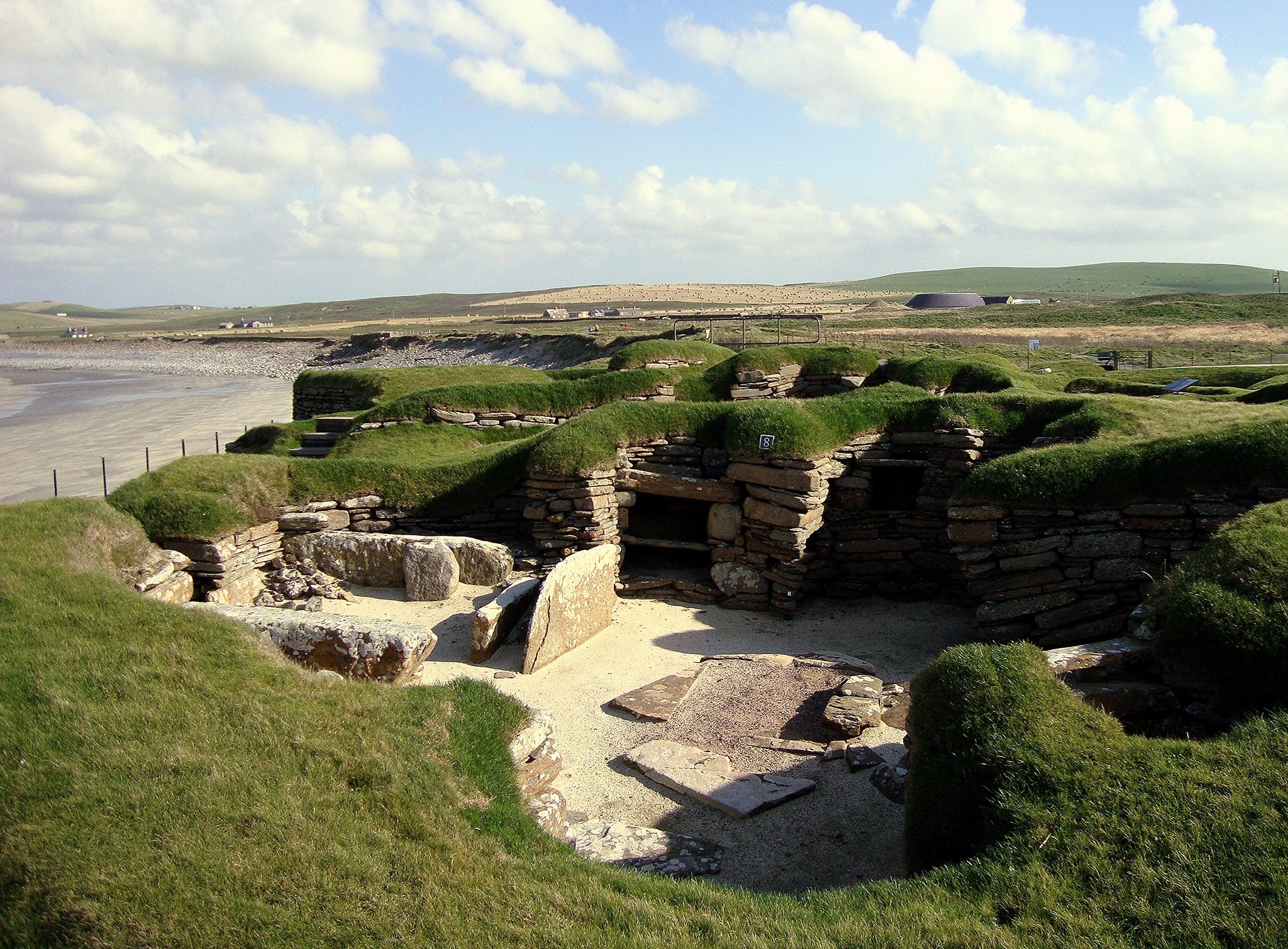
In the winter of 1850, a storm battered the west coast of Orkney. Nothing unusual there for a Scottish island, but this storm had an exceptionally high tide, and the force of the wind and sea stripped away the grass from a large mound, revealing the outline of a number of stone buildings.
Excavations revealed the Neolithic village of Skara Brae, hidden in the sand for over 40 centuries. During Neolithic times, the climate at Skara Brae was likely relatively mild and stable, allowing for agriculture, but it is believed to have become significantly colder and wetter around 2500 BC, which is thought to be a major reason why the settlement was abandoned.
1895 – The Great Frost
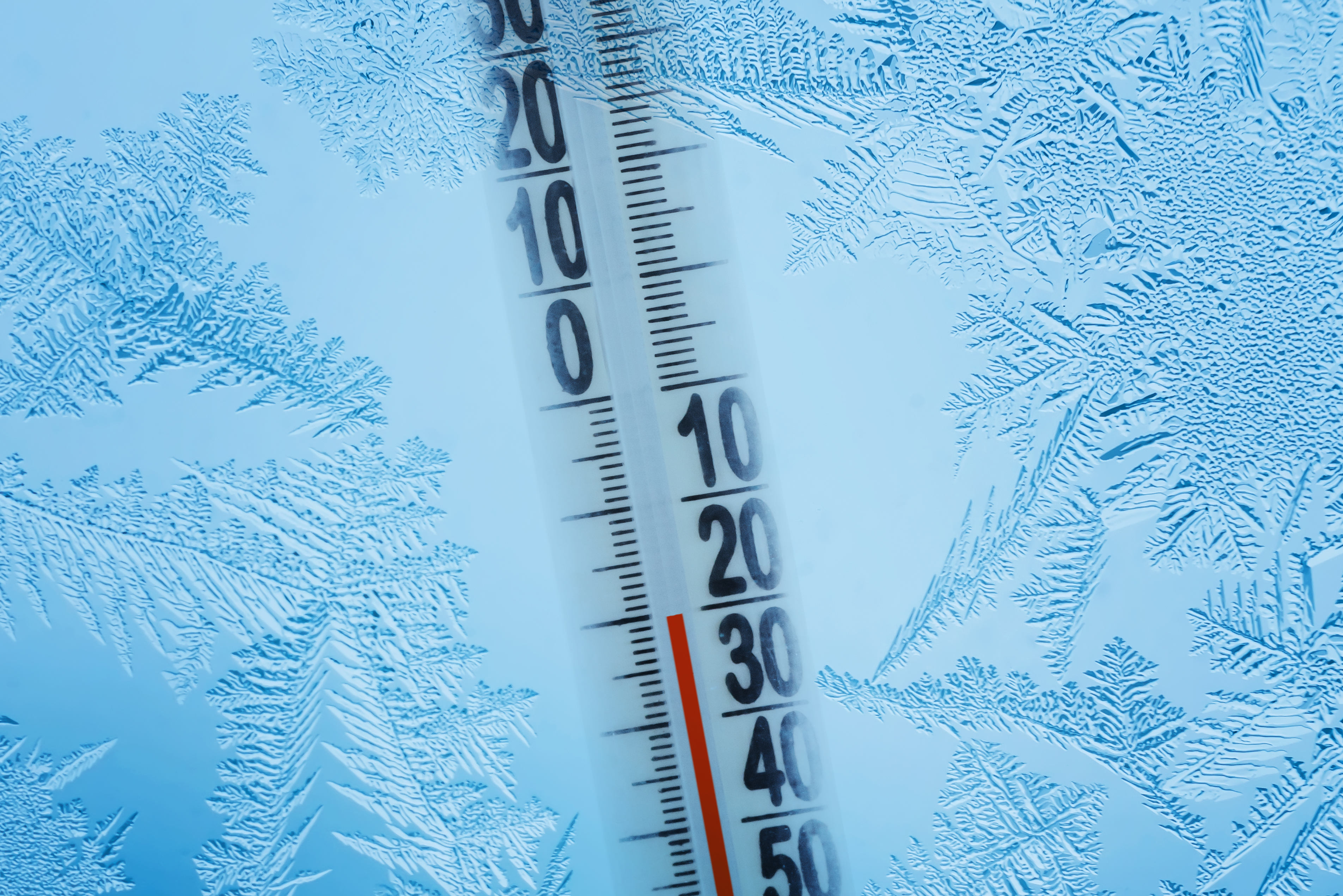
The lowest temperature recorded in the UK is -27.2°C (-17°F) at Braemar in Grampian on 11 February 1895. It took nearly a century before Braemar reached that value again on 10 January 1982, followed by Altnaharra in Highland on 30 December 1995.
But back to the cold of February 1895, when the British Isles experienced some of the most persistent and severe frosts ever recorded — a whopping 63 days of frost! Ice-bound rivers and estuaries hindered navigation, but people enjoyed the best ice-skating conditions of the 19th century on Lake Windermere and Loch Lomond.
1913 – The Deadliest Tornado
According to the Tornado and Storm Research Organisation (TORRO) an average of 36.5 tornadoes are reported each year in the UK. In fact, we get more tornadoes per square kilometre than the USA as a whole (2.2 per 10,000km² compared to 1.3). Luckily British tornadoes are much weaker than the twisters of Tornado Alley, with very few deaths in recent years.
The UK’s deadliest tornado on record on 27 October 1913 killed five people in Abercynon and Edwardsville, near Merthyr Tydfil in south Wales. The tornado was ranked as a T7 on the Tornado Intensity Scale.
1952 - The Great Smog
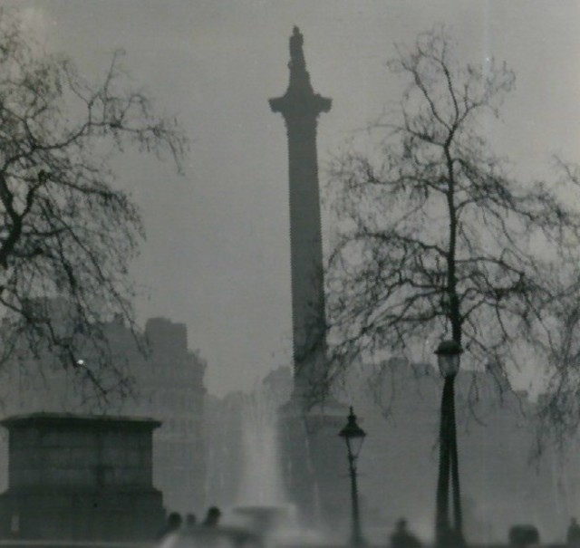
© N T Stobbs
https://commons.wikimedia.org/w/index.php?curid=4094275
Before the Clean Air Act of 1956, London was prone to smog – severe air pollution that results from a mixture of smoke and fog. The dense, yellow-green smoky fog resembled pea soup, hence the term “pea souper”. Smog was also a problem in other cities, such as Edinburgh, giving the city its nickname Auld Reekie (old smoky).
In December 1952, high pressure led to days of fog (4 days and 18 hours in London). The build-up of pollutants from coal fires and factories led to the deaths of thousands, mostly children and the elderly from acute bronchitis.
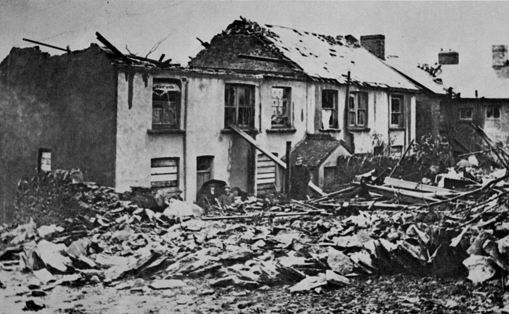
1953 – The North Sea Flood
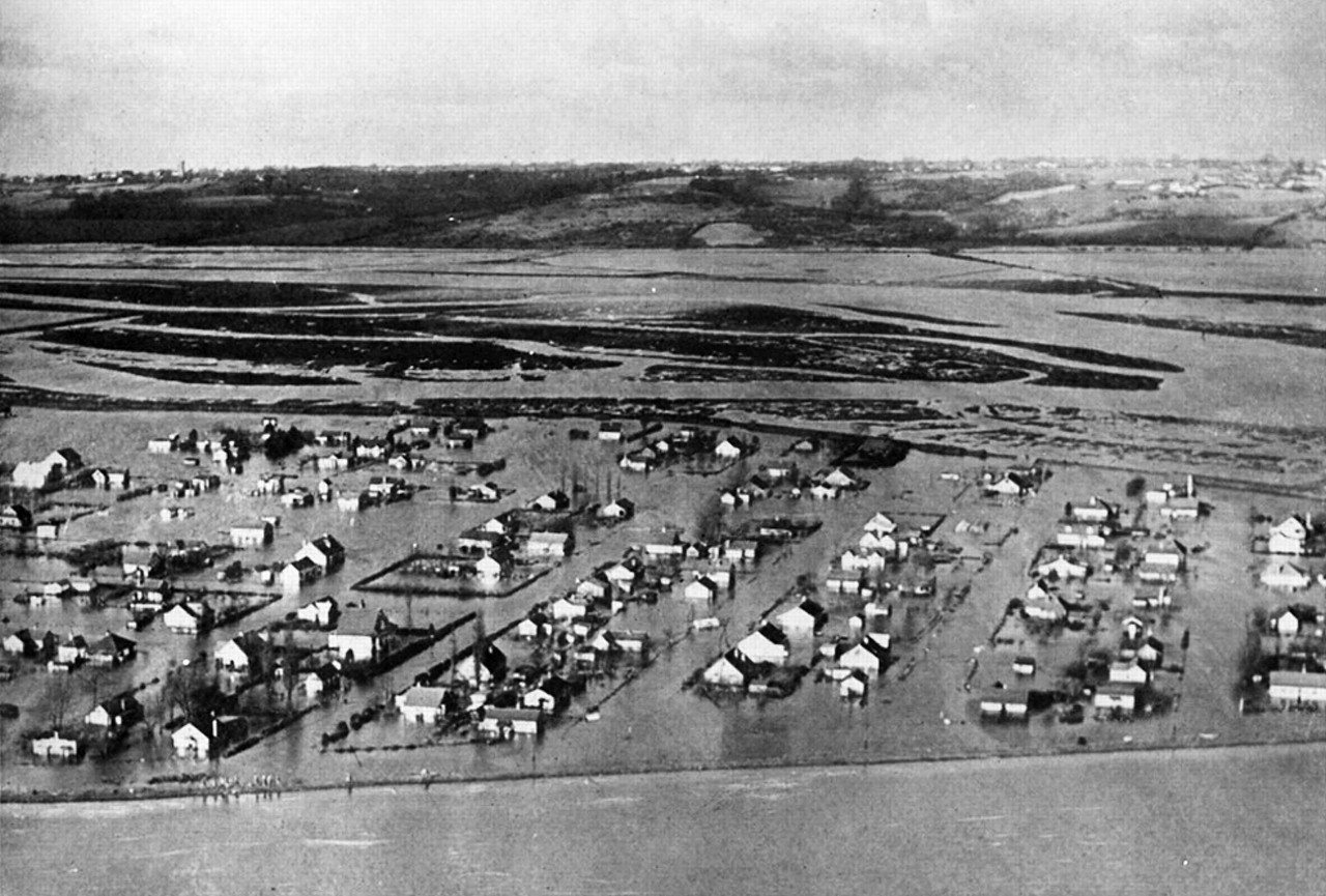
Image source: The Royal Society
On the night of 31 January 1953, Britain suffered one of its greatest peacetime disasters: a fatal combination of extreme weather conditions, high spring tides and an inability to warn people meant that huge numbers of people were unaware of an imminent storm surge that was about to inundate low-lying areas of East Anglia and the Thames Estuary, as well as parts of Scotland, the Netherlands and Belgium.
Catastrophic flooding, particularly in the Netherlands and eastern England, killed over 2,500 people. Around 160,000 acres of land, up to 2 miles inland, was flooded and unusable for several years afterwards.
1976 – The Great Drought

© Torfaen Corvine
The summer of 1976 has been noted as the most memorable heatwave with temperatures hitting nearly 36°C and exceptionally dry weather lasting 16 months, starting in May 1975.
From 22 June to 16 July 1976, somewhere in the UK exceeded 25°C every day. What’s more, for 15 consecutive days from 23 June to 7 July 1976 temperatures in Britain reached at least 32.2°C every day. No previous or subsequent heatwaves have produced more than five days in a row where temperatures have climbed above 32°C. The hottest day of 1976 was 3 July when temperatures hit 35.9°C. Much of England and Wales received less than 65% of average rainfall from May 1975 to August 1976, with some parts of southern England receiving less than 55%. The hot and dry summer of 1976 led to widespread water shortages and wildfires.
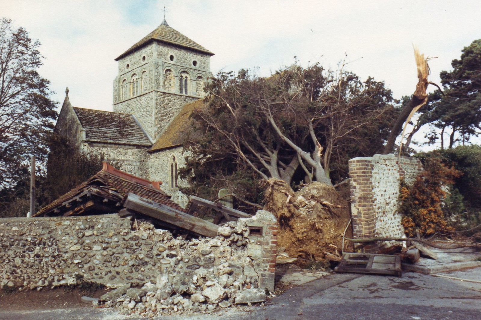
1987 – The Great Storm of 1987
© radcliffeC
The Great Storm of 1987 was one of the most violent storms to hit the UK in the 20th century. The storm originated from ex-hurricane Floyd, which still carried intense winds and caused significant damage when it transitioned into a severe extratropical cyclone over southern England on 15-16 October. Hurricane-force winds reached over 100mph in some areas, with gusts exceeding 120mph in the Isle of Wight and the English south coast.
The storm led to the deaths of 18 people, caused widespread damage and knocked down millions of trees. The Great Storm caught many by surprise, as forecasts had not predicted such a powerful system.
2003 – European Heatwave
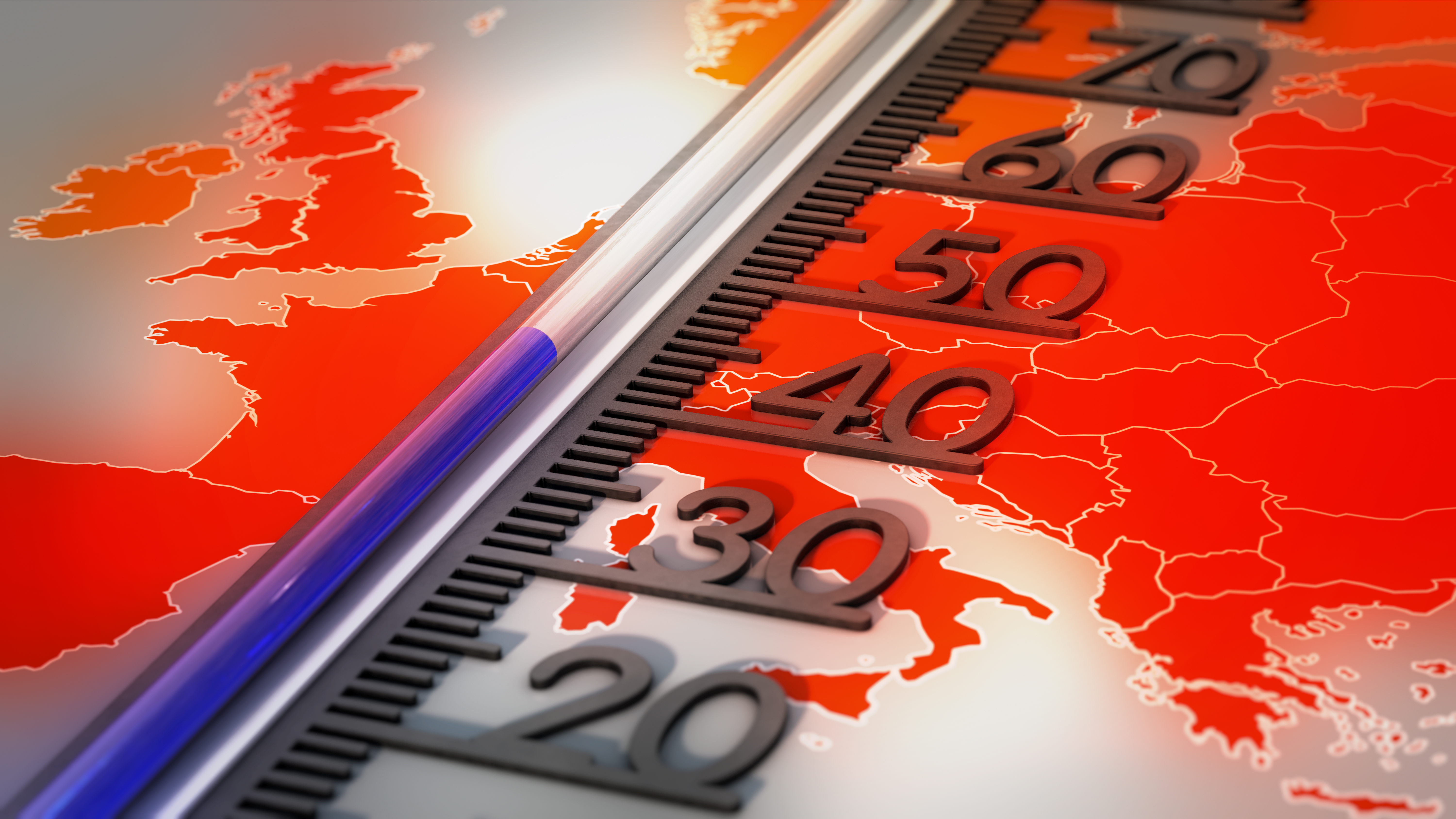
Record-breaking heat in the summer of 2003 caused tens of thousands of deaths across Europe, with France, Spain and the UK particularly affected.
The severe heatwave over large parts of Europe extended from June to mid-August, raising summer temperatures by 3 to 5°C in most of southern and central Europe. Maximum temperatures of 35 to 40°C were repeatedly recorded and peak temperatures climbed well above 40°C. The 2003 heatwave led to the development of heat health-watch warning systems in several European countries including France, Spain, Portugal, Italy, the UK and Hungary.
2004 – The Boscastle flood
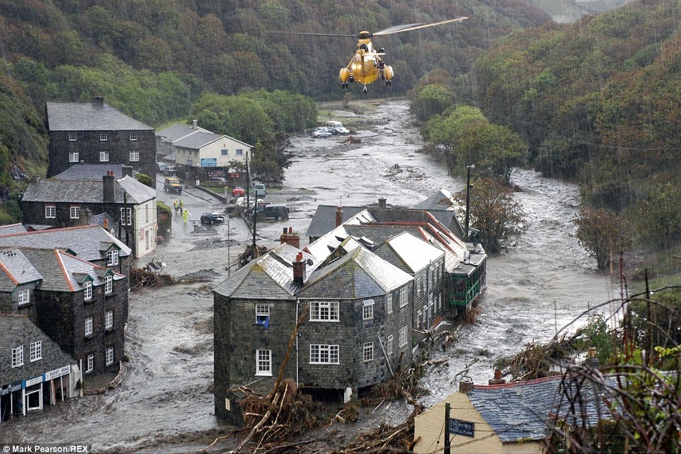
A combination of a quasi-stationary weather system, intense convectional rainfall, saturated ground and steep topography led to widespread flash flooding in the Cornish village of Boscastle on 16 August 2004.
Over 200mm of rain fell in just 4 hours, causing two rivers to burst their banks and sending a wall of water down the narrow valley and through the village. There were no fatalities, but many people had to be rescued by helicopter, cars were swept out to sea and buildings destroyed.
2005 – Hurricane Katrina
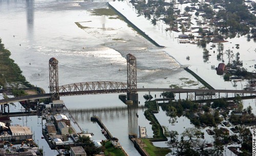
One of the most devastating and deadliest hurricanes in US history, Hurricane Katrina made landfall as a major Category 3 hurricane in August 2005, primarily affecting the Gulf coast, particularly Louisiana. Katrina’s massive size, 125mph wind gusts and storm surge overwhelmed levees, causing catastrophic flooding in New Orleans with 80% of the city left underwater.
At least 1800 people died, with over a million displaced from their homes. The storm’s slow-moving nature and the delayed emergency response exacerbated the disaster. It’s estimated that Katrina caused $125 billion in damage, one of the costliest natural disasters in US history.
2010 – Coldest December in over 100 years
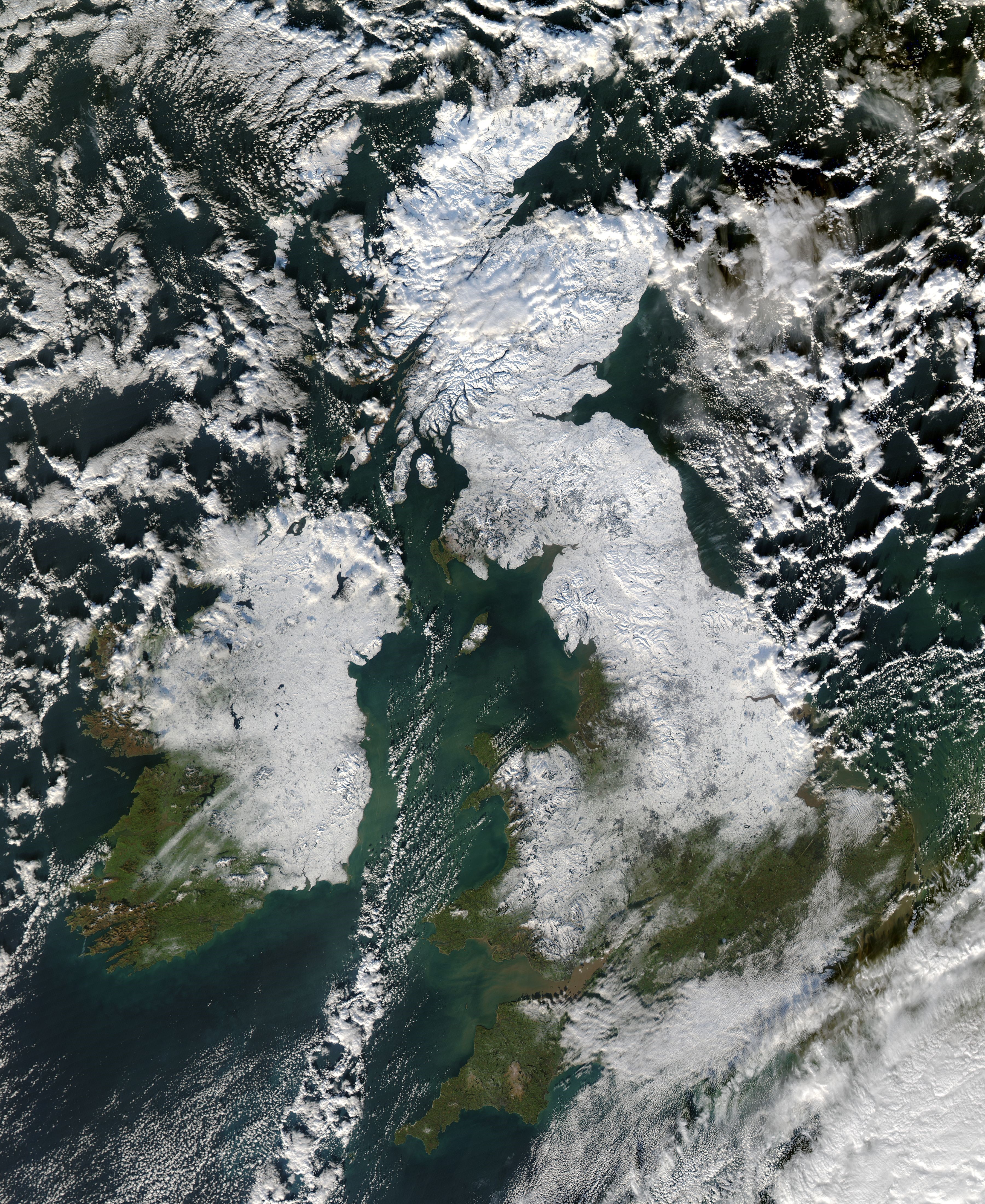
NASA images courtesy Jeff Schmaltz, MODIS Rapid Response Team at NASA GSFC
From late November until Christmas 2010, the UK experienced two spells of severe winter weather, with very low temperatures and copious amounts of snow. Average temperatures in December 2010 were -1.5°C, more than 5°C below the long-term average. The snow created chaos on the roads, especially in southern England, and many airports were forced to close temporarily.
The last widespread White Christmas in the UK was back in December 2010. Not only was there snow on the ground at 83 per cent of stations (the highest amount ever recorded) but snow or sleet also fell at 19 per cent of stations during the 24 hours of Christmas Day.
2018 – The Beast from the East

A severe cold snap in late February and early March 2018 became known as the Beast from the East. It was caused by a cold air mass from Siberia, which brought heavy snow, record-low temperatures and widespread disruption. The cold air collided with a storm system from the Atlantic, causing blizzards in many parts of the country, particularly in the Midlands and eastern England.
Temperatures plummeted to -10°C in some areas, and parts of the country experienced the coldest February in 27 years. The cold easterly winds, snow and ice, led to power outages, snowdrifts, and widespread travel chaos.
2021 – British Columbia Heatwave (Canada)
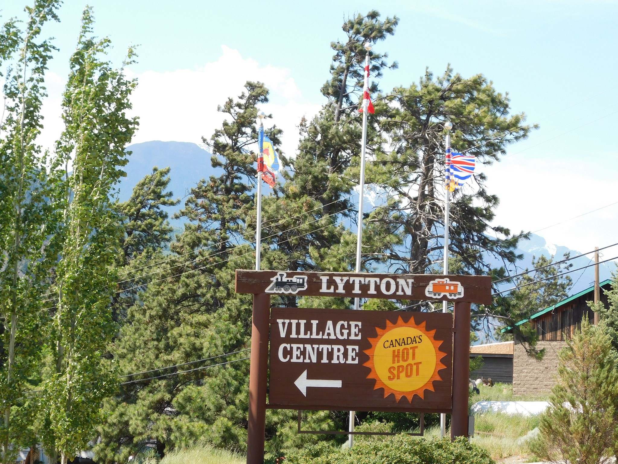
In late June 2021, a record-breaking heatwave in western Canada resulted in extreme temperatures, with Lytton, British Columbia, reaching 49.6°C (121.3°F), the highest temperature ever recorded in Canada. The heatwave lasted for several days, leading to wildfires, health issues, significant environmental damage and hundreds of deaths. A "heat dome" was blamed for the extreme heat.
Just two days after the temperature record was set, a devastating wildfire swept through Lytton. The town was almost completely burned to the ground and the weather station was also destroyed in the blaze. The heatwave and wildfires sparked discussions about the role of climate change in such extreme weather events.
2022 – Hottest day in the UK
The UK's highest recorded temperature is 40.3°C (104.5°F), set on 19 July 2022 at Coningsby in Lincolnshire. This marked the first time in UK history that temperatures exceeded 40°C, setting a new national record. Other locations across England also exceeded 40°C that day, including London's Heathrow Airport. Temperature records were also broken in Wales and Scotland that day, with 37.1°C in Hawarden and 34.8°C in Charterhall. The heatwave also caused widespread disruption, with wildfires, transport delays, and significant concerns about drought and water shortages.
The high temperatures came courtesy of a hot air mass that had come from North Africa, boosted by a heat dome. Global warming and climate change have made such extreme temperature events more likely, as rising global temperatures increase the frequency and intensity of heatwaves.
2024 – Most named storms
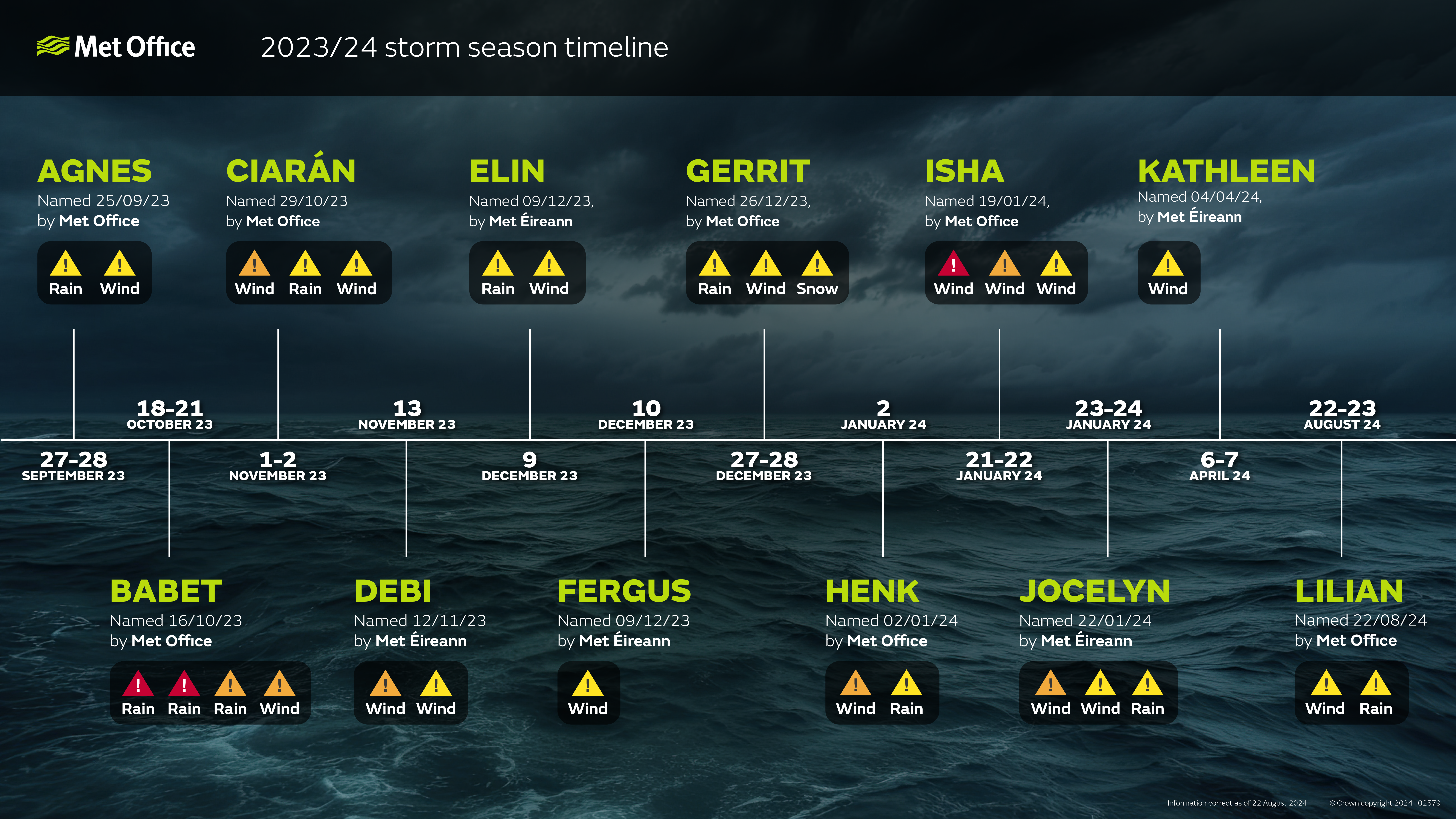
From Storm Agnes in September 2023 through to Storm Lilian in August 2024, the UK experienced the highest number of named storms since the storm-naming system was launched in 2015, with 12 named systems during the 2023-2024 storm season.
Storm Ciarán was an exceptionally severe storm, but its path led to the worst of its impacts being felt in the Channel Islands and France. The strongest winds from Storm Ciarán were shifted to the south of the UK, with northern France and the Channel Islands having wind speeds comparable to the Great Storm of 1987. UK wind gusts peaked at 78mph, but some stations in the north of France exceeded 100mph, and a tornado reportedly affected eastern parts of Jersey.


